سعر فوب
أحصل على آخر سعر600 ~ 700 USD / Box ( Negotiable )
|300 Box Minimum Order
بلد:
China
نموذج رقم:
-
سعر فوب:
600 ~ 700 USD / Box ( Negotiable ) أحصل على آخر سعر
الموقع:
china
سعر الحد الأدنى للطلب:
600 per Box
الحد الأدني للطلب:
300 Box
تفاصيل التغليف:
pec
موعد التسليم:
express delivery
القدرة على التوريد:
20 Box per Month
نوع الدفع:
D/P, L/C, T/T
مجموعة المنتج :
-

China
الشخص الذي يمكن الاتصال به 毛丽
Qingdao, Shandong
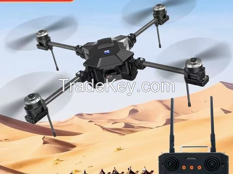
UAVs are used for geographic information collection (GIS), terrain
mapping, and 3D modeling. They use high-precision sensors and data
processing software to quickly generate high-resolution maps,
digital elevation models (DEMs), orthophotos.Core technology and
configuration 1. Hardware Design
- **Platform type**:
- **Fixed-wing drone**: It is suitable for large area mapping (e.g.
The Forest, mining area), long range (**2 hours), wide range (up to
tens of square kilometers per flight), e.g., SenseFly eBee X.
- ** Multi-rotor drone**: Flexible hovering, suitable for
small-scale high-precision surveying (such as construction sites,
urban modeling), such as the **DJI Matrice **0 RTK**.
- ** Vertical takeoff and landing (VTOL) drone**: Combining
fixed-wing endurance and multi-rotor takeoff and landing
convenience, it is suitable for complex terrains such as mountains
and islands.
| بلد: | China |
| نموذج رقم: | - |
| سعر فوب: | 600 ~ 700 / Box ( Negotiable ) أحصل على آخر سعر |
| الموقع: | china |
| سعر الحد الأدنى للطلب: | 600 per Box |
| الحد الأدني للطلب: | 300 Box |
| تفاصيل التغليف: | pec |
| موعد التسليم: | express delivery |
| القدرة على التوريد: | 20 Box per Month |
| نوع الدفع: | D/P, L/C, T/T |
| مجموعة المنتج : | - |


